欢迎大家赞助一杯啤酒🍺 我们准备了下酒菜:Formal mathematics/Isabelle/ML, Formal verification/Coq/ACL2/Agda, C++/Lisp/Haskell
GRASS
来自开放百科 - 灰狐
(版本间的差异)
(→Links) |
|||
| (未显示1个用户的1个中间版本) | |||
| 第1行: | 第1行: | ||
| + | {{SeeWikipedia}} | ||
| + | |||
Geographic Resources Analysis Support System, commonly referred to as GRASS GIS, is a Geographic Information System (GIS) used for data management, image processing, graphics production, spatial modelling, and visualization of many types of data. It is Free (Libre) Software/Open Source released under GNU General Public License (GPL). GRASS is official project of the [http://www.osgeo.org/ Open Source Geospatial Foundation]. | Geographic Resources Analysis Support System, commonly referred to as GRASS GIS, is a Geographic Information System (GIS) used for data management, image processing, graphics production, spatial modelling, and visualization of many types of data. It is Free (Libre) Software/Open Source released under GNU General Public License (GPL). GRASS is official project of the [http://www.osgeo.org/ Open Source Geospatial Foundation]. | ||
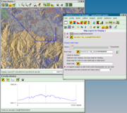
[[Image:grass63_gism_profile.png|right|thumb|GRASS 6.3 in action]] | [[Image:grass63_gism_profile.png|right|thumb|GRASS 6.3 in action]] | ||
| 第4行: | 第6行: | ||
*http://grass.itc.it | *http://grass.itc.it | ||
*http://grass.osgeo.org/ | *http://grass.osgeo.org/ | ||
| − | |||
*http://docs.huihoo.com/grass/ | *http://docs.huihoo.com/grass/ | ||
| + | |||
| + | [[Category:GIS]] | ||
2010年9月20日 (一) 01:57的最后版本
| |
您可以在Wikipedia上了解到此条目的英文信息 GRASS Thanks, Wikipedia. |
Geographic Resources Analysis Support System, commonly referred to as GRASS GIS, is a Geographic Information System (GIS) used for data management, image processing, graphics production, spatial modelling, and visualization of many types of data. It is Free (Libre) Software/Open Source released under GNU General Public License (GPL). GRASS is official project of the Open Source Geospatial Foundation.
[编辑] Links
分享您的观点
