欢迎大家赞助一杯啤酒🍺 我们准备了下酒菜:Formal mathematics/Isabelle/ML, Formal verification/Coq/ACL2/Agda, C++/Lisp/Haskell
UDig
来自开放百科 - 灰狐
(版本间的差异)
小 (→Screenshots) |
|||
| (未显示1个用户的2个中间版本) | |||
| 第1行: | 第1行: | ||
| − | + | {{SeeWikipedia}} | |
| − | + | uDig is an open source desktop GIS application framework, distributed under the LGPL license. | |
| − | uDig | + | uDig built with Eclipse Rich Client (RCP) technology. |
* uDig can be used as a stand-alone application. | * uDig can be used as a stand-alone application. | ||
* uDig can be extended with RCP “plug-ins”. | * uDig can be extended with RCP “plug-ins”. | ||
| 第14行: | 第14行: | ||
* GIS ready, providing the framework on which complex analytical capabilities can be built, and gradually subsuming those capabilities into the main application. | * GIS ready, providing the framework on which complex analytical capabilities can be built, and gradually subsuming those capabilities into the main application. | ||
| − | |||
| − | |||
==Links== | ==Links== | ||
*http://udig.refractions.net/ | *http://udig.refractions.net/ | ||
*http://download.huihoo.com/udig/ | *http://download.huihoo.com/udig/ | ||
*http://docs.huihoo.com/udig/ | *http://docs.huihoo.com/udig/ | ||
| + | |||
| + | ==Screenshots== | ||
| + | <gallery perrow=5> | ||
| + | Image:udig-taaka1.png|TAAKA | ||
| + | Image:udig-jgrass3.png|JGrass | ||
| + | Image:udig-eurobios1.png|Eurobios Waste | ||
| + | </gallery> | ||
| + | |||
| + | [[category:GIS]] | ||
| + | [[category:eclipse]] | ||
2020年9月22日 (二) 09:35的最后版本
| |
您可以在Wikipedia上了解到此条目的英文信息 UDig Thanks, Wikipedia. |
uDig is an open source desktop GIS application framework, distributed under the LGPL license.
uDig built with Eclipse Rich Client (RCP) technology.
- uDig can be used as a stand-alone application.
- uDig can be extended with RCP “plug-ins”.
- uDig can be used as a plug-in in an existing RCP application.
The goal of uDig is to provide a complete Java solution for desktop GIS data access, editing, and viewing. uDig aims to be:
- User friendly, providing a familiar graphical environment for GIS users;
- Desktop located, running as a thick client, natively on Windows, Mac OS/X and Linux;
- Internet oriented, consuming standard (WMS, WFS, WCS) and de facto (GeoRSS, KML, tiles) geospatial web services; and,
- GIS ready, providing the framework on which complex analytical capabilities can be built, and gradually subsuming those capabilities into the main application.
[编辑] Links
[编辑] Screenshots
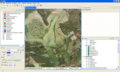
TAAKA
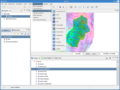
JGrass
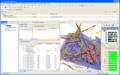
Eurobios Waste


分享您的观点